Fil:Albanian Kingdom (1939).svg

Size of this PNG preview of this SVG file: 450 × 456 pixels. Andre opløsninger: 237 × 240 pixels | 474 × 480 pixels | 758 × 768 pixels | 1.011 × 1.024 pixels | 2.021 × 2.048 pixels.
Fuld opløsning (SVG fil, basisstørrelse 450 × 456 pixels, filstørrelse: 452 KB)
|
|
Denne fil er fra Wikimedia Commons. Beskrivelsen af filen fra Commons er gengivet nedenfor. |


.svg)
.svg)
.svg)
.svg)
.svg)


.svg)
.svg)
.svg)


.png)
.png)


.svg)


.svg)

.svg)


.svg)
.svg)
.svg)
.svg)


.svg)
.png)


.svg)


.svg)
.svg)


.svg)


.svg)


.svg?uselang=da)
.svg)
.svg)
.svg)
.svg)
.svg)
.svg)
.svg)
_cropped.svg)
.svg)
.svg)
.svg)
.svg)
.svg)
.svg)
.svg)
.svg)
.svg)
.svg)
.svg)
.svg)
.svg)
.svg)
.svg)
.svg)
.svg)
.svg)
.svg)
.svg)
.svg)
.svg)
.svg)
.svg)
.svg)
.svg)
.svg)
.svg)
.svg)
.svg)
.svg)
.svg)
.svg)
.svg)
.svg)
.svg)
.svg)
.svg)
.svg)
.svg)
.svg)
.svg)
.svg)
.svg)
Filhistorik
Klik på en dato/tid for at se filen som den så ud på det tidspunkt.
| Dato/tid | Miniaturebillede | Dimensioner | Bruger | Kommentar | |
|---|---|---|---|---|---|
| nuværende | 25. jul. 2013, 19:23 | | 450 × 456 (452 KB) | Alphathon | Removed the Flevoland polders (Netherlands) which were not completed until 1942/1968 |
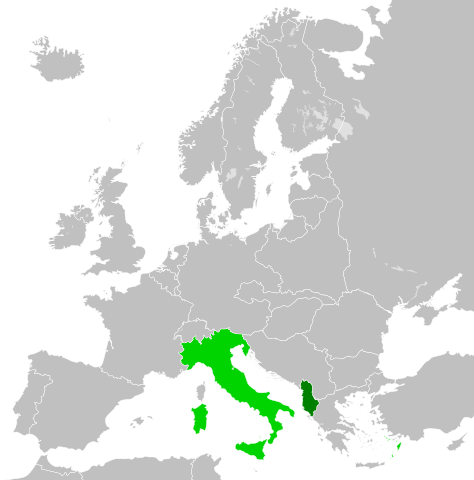
| 27. jun. 2012, 05:33 |  | 450 × 456 (453 KB) | TRAJAN 117 | {{Information |Description ={{en|1=The Albanian Kingdom, with the Kingdom of Italy in 1939.}} |Source ={{own}} {{AttribSVG|Blank map of Europe October 1938 - March 1939.svg|Alphathon}} |Author =TRAJAN 117 {{create... |
Filanvendelse
Den følgende side bruger denne fil:
Global filanvendelse
Følgende andre wikier anvender denne fil:
- Anvendelser på azb.wikipedia.org
- Anvendelser på el.wikipedia.org
- Anvendelser på en.wikipedia.org
- Anvendelser på fi.wikipedia.org
- Anvendelser på fr.wikipedia.org
- Anvendelser på it.wikipedia.org
- Anvendelser på ko.wikipedia.org
- Anvendelser på ms.wikipedia.org
- Anvendelser på pt.wikipedia.org
- Anvendelser på ru.wikipedia.org
- Anvendelser på sr.wikipedia.org
- Anvendelser på zh.wikipedia.org
.svg)