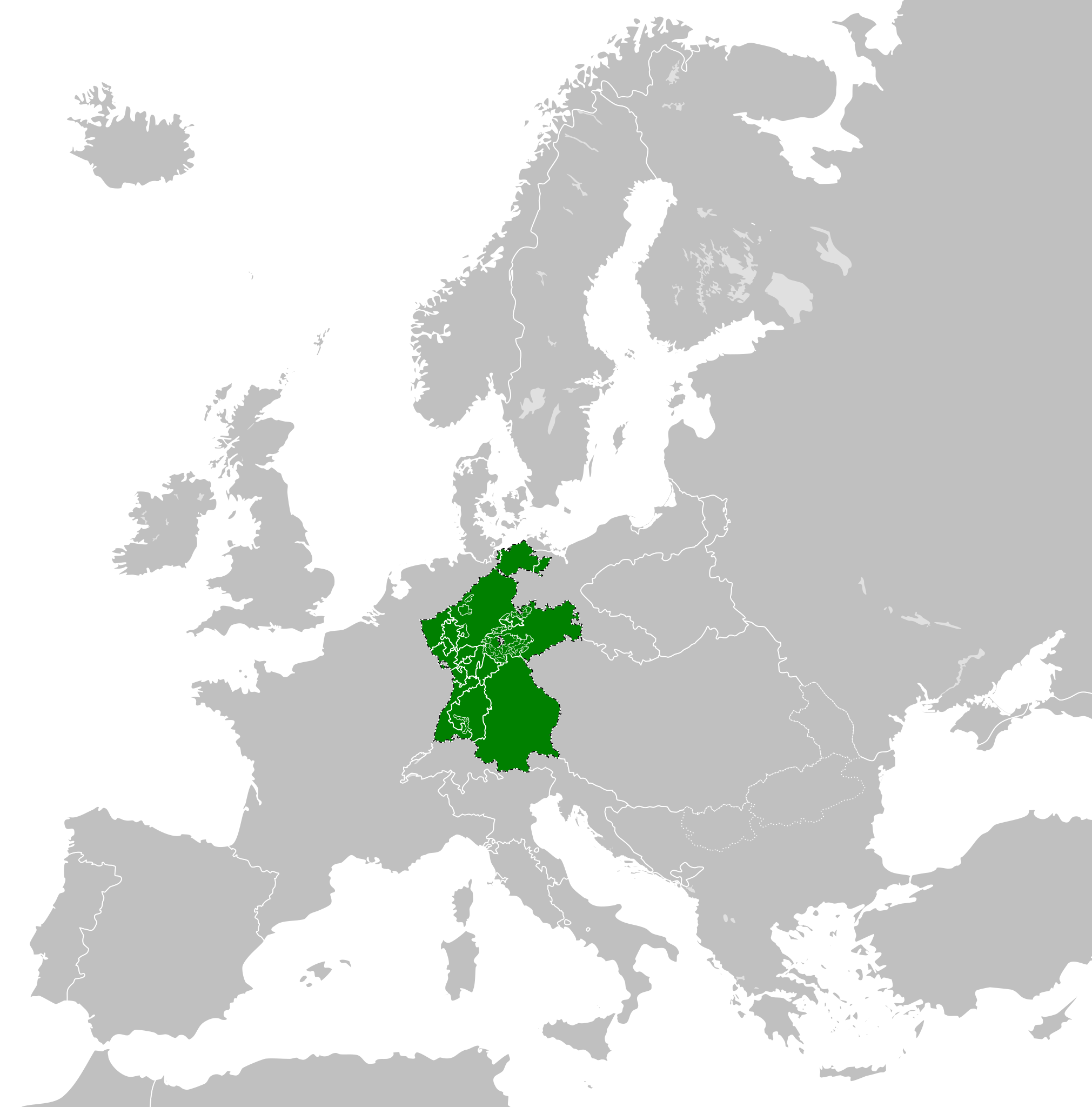
Fil:Confederation of the Rhine (1812).svg

Size of this PNG preview of this SVG file: 450 × 456 pixels. Andre opløsninger: 237 × 240 pixels | 474 × 480 pixels | 758 × 768 pixels | 1.011 × 1.024 pixels | 2.021 × 2.048 pixels.
Fuld opløsning (SVG fil, basisstørrelse 450 × 456 pixels, filstørrelse: 611 KB)
|
|
Denne fil er fra Wikimedia Commons. Beskrivelsen af filen fra Commons er gengivet nedenfor. |
Beskrivelse


.svg)
.svg)
.svg)
.svg)
.svg)


.svg)
.svg)
.svg)


.png)
.png)


.svg)


.svg)

.svg)


.svg)
.svg)
.svg)
.svg)


.svg)
.png)


.svg)


.svg)
.svg)


.svg)


.svg)


.svg?uselang=da)
.svg)
.svg)
.svg)
.svg)
.svg)
.svg)
.svg)
_cropped.svg)
.svg)
.svg)
.svg)
.svg)
.svg)
.svg)
.svg)
.svg)
.svg)
.svg)
.svg)
.svg)
.svg)
.svg)
.svg)
.svg)
.svg)
.svg)
.svg)
.svg)
.svg)
.svg)
.svg)
.svg)
.svg)
.svg)
.svg)
.svg)
.svg)
.svg)
.svg)
.svg)
.svg)
.svg)
.svg)
.svg)
.svg)
.svg)
.svg)
.svg)
.svg)
.svg)
.svg)
.svg)
.svg)
Filhistorik
Klik på en dato/tid for at se filen som den så ud på det tidspunkt.
| Dato/tid | Miniaturebillede | Dimensioner | Bruger | Kommentar | |
|---|---|---|---|---|---|
| nuværende | 5. jan. 2018, 16:59 | | 450 × 456 (611 KB) | TRAJAN 117 | +++ |
| 3. okt. 2013, 17:35 |  | 450 × 456 (607 KB) | Alphathon | Added constituent states | |
| 30. jul. 2012, 20:34 |  | 450 × 456 (464 KB) | Alphathon | Fixed some principalities | |
| 23. feb. 2012, 19:07 |  | 450 × 456 (444 KB) | TRAJAN 117 | {{Information |Description ={{en|1=The Confederation of the Rhine in 1812.}} |Source ={{own}} {{AttribSVG|First French Empire 1812.svg|Alphathon}} |Author =25px '''[[User:TRAJAN 117|TRAJAN 1... |
Filanvendelse
Den følgende side bruger denne fil:
Global filanvendelse
Følgende andre wikier anvender denne fil:
- Anvendelser på ast.wikipedia.org
- Anvendelser på azb.wikipedia.org
- Anvendelser på be.wikipedia.org
- Anvendelser på cs.wikipedia.org
- Anvendelser på de.wikipedia.org
- Anvendelser på el.wikipedia.org
- Anvendelser på en.wikipedia.org
- Anvendelser på es.wikipedia.org
- Anvendelser på eu.wikipedia.org
- Anvendelser på fi.wikipedia.org
- Anvendelser på gd.wikipedia.org
- Anvendelser på gl.wikipedia.org
- Anvendelser på he.wikipedia.org
- Anvendelser på hr.wikipedia.org
- Anvendelser på hu.wikipedia.org
- Anvendelser på id.wikipedia.org
- Anvendelser på it.wikipedia.org
- Anvendelser på ja.wikipedia.org
- Anvendelser på ko.wikipedia.org
- Anvendelser på lt.wikipedia.org
- Anvendelser på lv.wikipedia.org
- Anvendelser på mk.wikipedia.org
- Anvendelser på mn.wikipedia.org
- Anvendelser på ms.wikipedia.org
- Anvendelser på pl.wikipedia.org
- Anvendelser på pt.wikipedia.org
- Anvendelser på ru.wikipedia.org
- Anvendelser på sco.wikipedia.org
- Anvendelser på sk.wikipedia.org
- Anvendelser på sl.wikipedia.org
- Anvendelser på sv.wikipedia.org
- Anvendelser på th.wikipedia.org
- Anvendelser på tr.wikipedia.org
- Anvendelser på www.wikidata.org
- Anvendelser på zh-yue.wikipedia.org
- Anvendelser på zh.wikipedia.org
.svg)