Fil:LakeChadBolaerialphoto.jpg
Der findes ingen højere opløsning af billedet
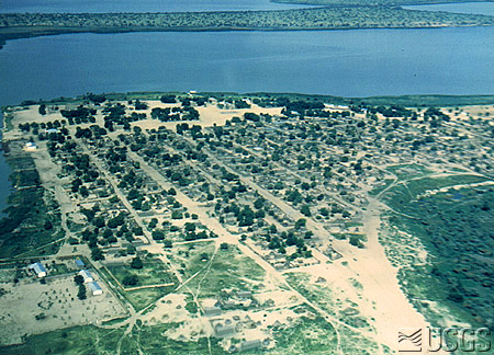
LakeChadBolaerialphoto.jpg (450 × 324 billedpunkter, filstørrelse: 104 KB, MIME-type: image/jpeg)
|
|
Denne fil er fra Wikimedia Commons. Beskrivelsen af filen fra Commons er gengivet nedenfor. |
Beskrivelse
Aerial photo of Bol, Chad, in 1971. From U.S. Geological Survey.
Licensering
This image is in the public domain in the United States because it only contains materials that originally came from the United States Geological Survey, an agency of the United States Department of the Interior. For more information, see the official USGS copyright policy.
|
Filhistorik
Klik på en dato/tid for at se filen som den så ud på det tidspunkt.
| Dato/tid | Miniaturebillede | Dimensioner | Bruger | Kommentar | |
|---|---|---|---|---|---|
| nuværende | 29. maj 2007, 11:15 | | 450 × 324 (104 KB) | Amcaja | Aerial photo of Bol, Chad, in 1971. From [http://edc.usgs.gov/earthshots/slow/LakeChad/LakeChadBolaerialphoto U.S. Geological Survey]. Category:Geography of Chad |
Filanvendelse
Den følgende side bruger denne fil:
Global filanvendelse
Følgende andre wikier anvender denne fil:
- Anvendelser på ar.wikipedia.org
- Anvendelser på arz.wikipedia.org
- Anvendelser på ca.wikipedia.org
- Anvendelser på ceb.wikipedia.org
- Anvendelser på de.wikipedia.org
- Anvendelser på en.wikipedia.org
- Anvendelser på en.wikivoyage.org
- Anvendelser på es.wikipedia.org
- Anvendelser på eu.wikipedia.org
- Anvendelser på fi.wikipedia.org
- Anvendelser på frr.wikipedia.org
- Anvendelser på fr.wikipedia.org
- Anvendelser på hi.wikipedia.org
- Anvendelser på hy.wikipedia.org
- Anvendelser på it.wikipedia.org
- Anvendelser på ja.wikipedia.org
- Anvendelser på mrj.wikipedia.org
- Anvendelser på nl.wikipedia.org
- Anvendelser på no.wikipedia.org
- Anvendelser på pa.wikipedia.org
- Anvendelser på pl.wikipedia.org
- Anvendelser på ro.wikipedia.org
- Anvendelser på ru.wikipedia.org
- Anvendelser på sh.wikipedia.org
- Anvendelser på su.wikipedia.org
- Anvendelser på sv.wikipedia.org
- Anvendelser på uk.wikipedia.org
- Anvendelser på www.wikidata.org
- Anvendelser på zh.wikipedia.org
- Anvendelser på zh.wikivoyage.org