Fil:Map of Alabama highlighting Washington County.svg

Size of this PNG preview of this SVG file: 379 × 600 pixels. Andre opløsninger: 152 × 240 pixels | 303 × 480 pixels | 485 × 768 pixels | 647 × 1.024 pixels | 1.294 × 2.048 pixels | 3.379 × 5.346 pixels.
Fuld opløsning (SVG fil, basisstørrelse 3.379 × 5.346 pixels, filstørrelse: 94 KB)
|
|
Denne fil er fra Wikimedia Commons. Beskrivelsen af filen fra Commons er gengivet nedenfor. |
Beskrivelse
| Beskrivelse |
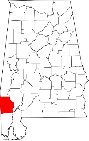
English: This is a locator map showing Washington County in Alabama. For more information, see Commons:United States county locator maps. |
| Dato | |
| Kilde |
Eget arbejde: English: The maps use data from nationalatlas.gov, specifically countyp020.tar.gz on the Raw Data Download page. The maps also use state outline data from statesp020.tar.gz. The Florida maps use hydrogm020.tar.gz to display Lake Okeechobee. |
| Forfatter | David Benbennick |
Licensering
| Jeg, indehaveren af ophavsretten til dette værk, udgiver dette værk som offentlig ejendom. Dette gælder i hele verden. I nogle lande er dette ikke juridisk muligt. I så fald: Jeg giver enhver ret til at anvende dette værk til ethvert formål, uden nogen restriktioner, medmindre sådanne restriktioner er påkrævede ved lov. |
Filhistorik
Klik på en dato/tid for at se filen som den så ud på det tidspunkt.
| Dato/tid | Miniaturebillede | Dimensioner | Bruger | Kommentar | |
|---|---|---|---|---|---|
| nuværende | 12. feb. 2006, 11:53 | | 3.379 × 5.346 (94 KB) | David Benbennick | {{subst:User:Dbenbenn/clm|county=Washington County|state=Alabama}} |
Filanvendelse
Den følgende side bruger denne fil:
Global filanvendelse
Følgende andre wikier anvender denne fil:
- Anvendelser på ar.wikipedia.org
- Anvendelser på arz.wikipedia.org
- Anvendelser på az.wikipedia.org
- Anvendelser på bg.wikipedia.org
- Anvendelser på bpy.wikipedia.org
- Anvendelser på ca.wikipedia.org
- Anvendelser på cdo.wikipedia.org
- Anvendelser på ceb.wikipedia.org
- Anvendelser på ce.wikipedia.org
- Anvendelser på cs.wikipedia.org
- Anvendelser på cy.wikipedia.org
- Anvendelser på de.wikipedia.org
- Anvendelser på en.wikipedia.org
- List of counties in Alabama
- Washington County, Alabama
- Chatom, Alabama
- McIntosh, Alabama
- Millry, Alabama
- St. Stephens, Alabama
- MOWA Band of Choctaw Indians
- Template:Washington County, Alabama
- User:Nyttend/County templates/AL
- Leroy, Alabama
- Calvert, Alabama
- Vinegar Bend, Alabama
- Deer Park, Alabama
- Category:Populated places in Washington County, Alabama
- Wagarville, Alabama
- Wakefield, Alabama
- Cullomburg, Alabama
- Fairford, Alabama
- Fruitdale, Alabama
- Hobson, Washington County, Alabama
- Malcolm, Alabama
- Sims Chapel, Alabama
- Tibbie, Alabama
- List of census-designated places in Alabama
- Sunflower, Alabama
- Frankville, Alabama
- National Register of Historic Places listings in Washington County, Alabama
- Yellow Pine, Alabama
Vis flere globale anvendelser af denne fil.