Fil:Muskegon Michigan harbor entrance.jpg
Størrelse af denne forhåndsvisning: 800 × 530 pixels. Andre opløsninger: 320 × 212 pixels | 640 × 424 pixels | 1.024 × 678 pixels | 1.500 × 993 pixels.
Fuld opløsning (1.500 × 993 billedpunkter, filstørrelse: 516 KB, MIME-type: image/jpeg)
|
|
Denne fil er fra Wikimedia Commons. Beskrivelsen af filen fra Commons er gengivet nedenfor. |
| Beskrivelse |
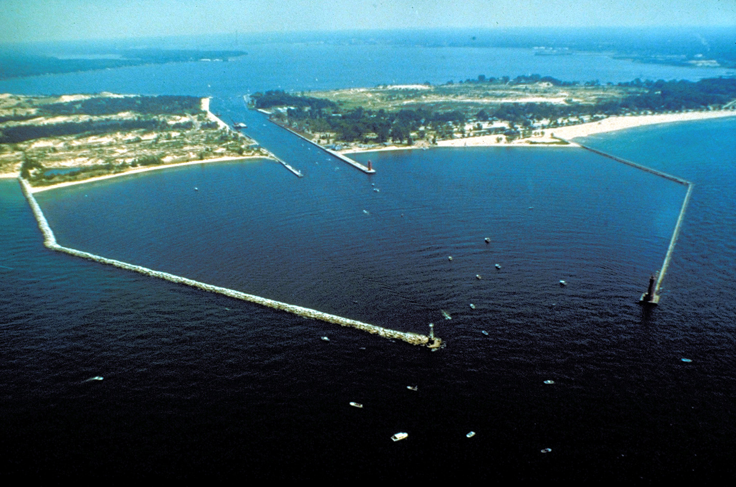
English: The breakwaters and harbor entrance on Lake Michigan at Muskegon, Muskegon County, Michigan, USA. The harbor entrance opens into Muskegon Lake, on which the city is situated. |
|||
| Dato | not specified or unknown | |||
| Kilde |
U.S. Army Corps of Engineers Digital Visual Library Image page Image description page Digital Visual Library home page |
|||
| Forfatter | U.S. Army Corps of Engineers, photographer not specified or unknown | |||
| Tilladelse (Genbrug af denne fil) |
|
|||
| Placering | Muskegon, Michigan, USA |
| Kameraposition | | Dette og andre billeder på deres position på: OpenStreetMap |
|---|
Filhistorik
Klik på en dato/tid for at se filen som den så ud på det tidspunkt.
| Dato/tid | Miniaturebillede | Dimensioner | Bruger | Kommentar | |
|---|---|---|---|---|---|
| nuværende | 29. mar. 2007, 03:24 | | 1.500 × 993 (516 KB) | DanMS | {{Information | Description = {{en|The breakwaters and harbor entrance on Lake Michigan at Muskegon, Muskegon County, Michigan, USA. The harbor entrance opens into Muskegon Lake, on which the city is situated.}} | Source = U.S. Army Corps of En |
Filanvendelse
Den følgende side bruger denne fil:
Global filanvendelse
Følgende andre wikier anvender denne fil:
- Anvendelser på ar.wikipedia.org
- Anvendelser på arz.wikipedia.org
- Anvendelser på be.wikipedia.org
- Anvendelser på ca.wikipedia.org
- Anvendelser på ceb.wikipedia.org
- Anvendelser på ce.wikipedia.org
- Anvendelser på cs.wikipedia.org
- Anvendelser på cy.wikipedia.org
- Anvendelser på dag.wikipedia.org
- Anvendelser på en.wikipedia.org
- Anvendelser på en.wikivoyage.org
- Anvendelser på eo.wikipedia.org
- Anvendelser på es.wikipedia.org
- Anvendelser på eu.wikipedia.org
- Anvendelser på fr.wikipedia.org
- Anvendelser på hu.wikipedia.org
- Anvendelser på ia.wikipedia.org
- Anvendelser på it.wikipedia.org
- Anvendelser på ja.wikipedia.org
- Anvendelser på ko.wikipedia.org
- Anvendelser på ky.wikipedia.org
- Anvendelser på lld.wikipedia.org
- Anvendelser på no.wikipedia.org
- Anvendelser på pl.wikipedia.org
- Anvendelser på pt.wikipedia.org
- Anvendelser på sr.wikipedia.org
- Anvendelser på tr.wikipedia.org
- Anvendelser på tt.wikipedia.org
- Anvendelser på uk.wikipedia.org
- Anvendelser på uz.wikipedia.org
- Anvendelser på vo.wikipedia.org
- Anvendelser på www.wikidata.org
- Anvendelser på zh-min-nan.wikipedia.org