Fil:1945-02-01GerWW2BattlefrontAtlas.jpg
Størrelse af denne forhåndsvisning: 625 × 599 pixels. Andre opløsninger: 250 × 240 pixels | 501 × 480 pixels | 801 × 768 pixels | 1.270 × 1.218 pixels.
Fuld opløsning (1.270 × 1.218 billedpunkter, filstørrelse: 1,25 MB, MIME-type: image/jpeg)
|
|
Denne fil er fra Wikimedia Commons. Beskrivelsen af filen fra Commons er gengivet nedenfor. |
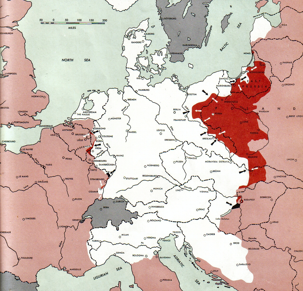
Atlas of the World Battle Fronts - War against Germany: 1945-02-01
← Previous map: 1945-01-15
→ Next map: 1945-02-15
Beskrivelse
| Beskrivelse |
Neutral nations (Sweden, Switzerland, Spain, Andorra)
Under Allied control
  July 1, 1943 to June 30 1945 To the Secretary of War". (See Cover, Foreword and Map details)  |
| Dato | |
| Kilde | Document "Atlas of the World Battle Fronts in Semimonthly Phases to August 15th 1945: Supplement to The Biennial report of the Chief of Staff of the United States Army July 1, 1943 to June 30 1945 To the Secretary of War" |
| Forfatter | Army Map Service |
| Tilladelse (Genbrug af denne fil) |
Public Domain: Work of US army |
Licensering
This file is a work of a U.S. Army soldier or employee, taken or made as part of that person's official duties. As a work of the U.S. federal government, it is in the public domain in the United States.
|
 |
Filhistorik
Klik på en dato/tid for at se filen som den så ud på det tidspunkt.
| Dato/tid | Miniaturebillede | Dimensioner | Bruger | Kommentar | |
|---|---|---|---|---|---|
| nuværende | 28. aug. 2011, 11:17 | | 1.270 × 1.218 (1,25 MB) | Cropbot | upload cropped version, operated by User:Finavon. Summary: caption cropped |
| 24. dec. 2007, 21:15 |  | 1.274 × 1.702 (1,7 MB) | Mike Young | {{Information |Description= thumb|left|75pxthumb|right|75pxMap of the front against Germany: This map is taken from the source "Atlas of the World Battle Fronts in Semimonthly |
Filanvendelse
Den følgende side bruger denne fil:
Global filanvendelse
Følgende andre wikier anvender denne fil:
- Anvendelser på de.wikipedia.org
- Anvendelser på en.wikipedia.org
- Anvendelser på en.wikisource.org
- Anvendelser på id.wikipedia.org
- Anvendelser på no.wikipedia.org
- Anvendelser på sh.wikipedia.org
- Anvendelser på uk.wikipedia.org
- Anvendelser på vi.wikipedia.org