Fil:EWR Airport Diagram.svg

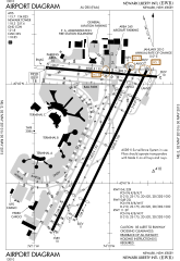
Size of this PNG preview of this SVG file: 378 × 548 pixels. Andre opløsninger: 165 × 240 pixels | 331 × 480 pixels | 530 × 768 pixels | 706 × 1.024 pixels | 1.413 × 2.048 pixels.
Fuld opløsning (SVG fil, basisstørrelse 378 × 548 pixels, filstørrelse: 874 KB)
|
|
Denne fil er fra Wikimedia Commons. Beskrivelsen af filen fra Commons er gengivet nedenfor. |
Beskrivelse
| Beskrivelse |
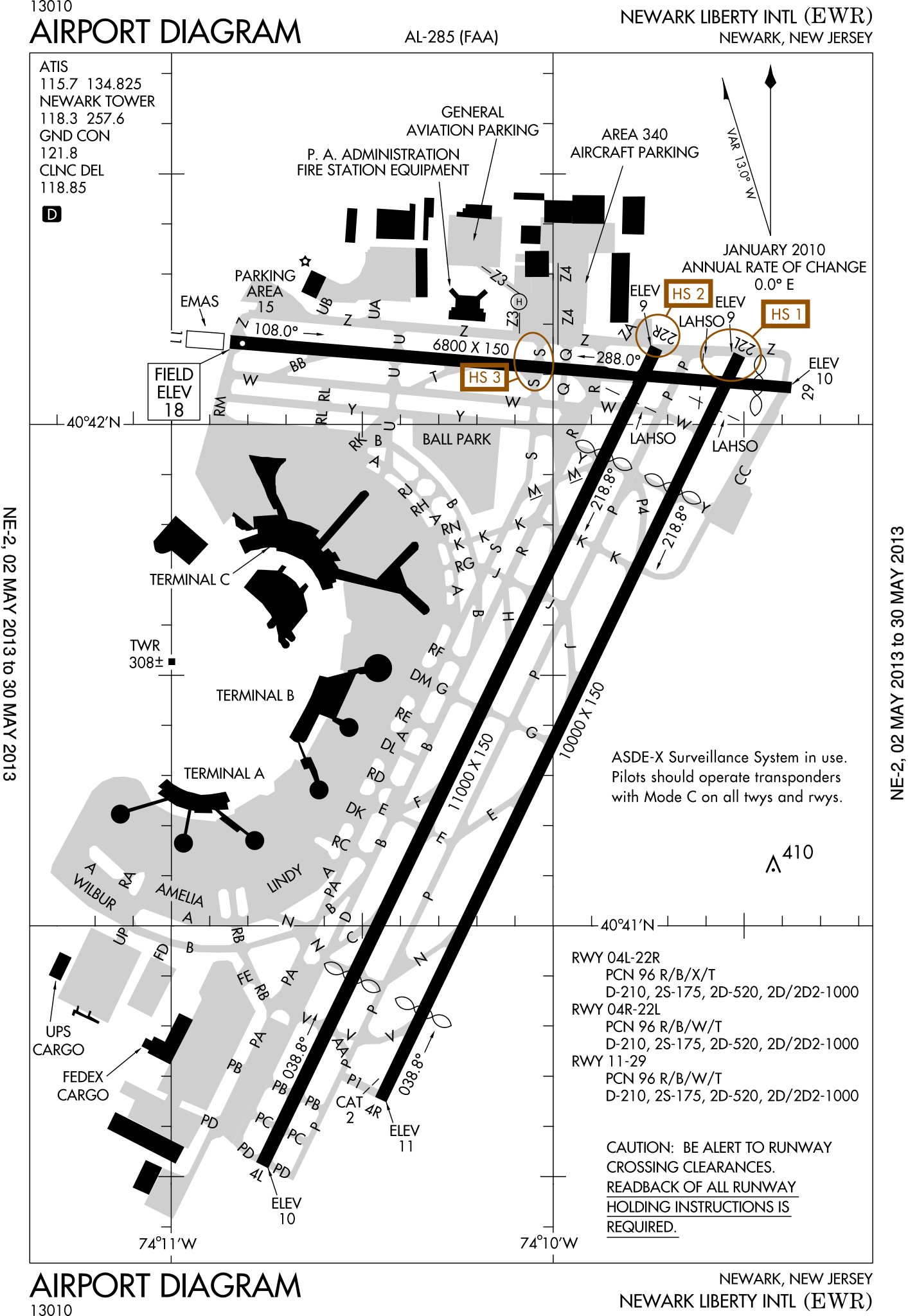
English: FAA Airport Diagram of Newark Liberty International Airport. |
| Dato | |
| Kilde |
FAA Airport Diagrams; note that these change every 28 days. Taken from PDF on FAA site and converted to SVG using en:Wikipedia:How to draw SVG circuits using Xcircuit. |
| Forfatter | Produced by the National Aeronautical Charting Office (NACO), a department of the United States en:Federal Aviation Administration. |
| Kameraposition | | Dette og andre billeder på deres position på: OpenStreetMap |
|---|
W3C-validity not checked.
Licensering
This image or file is a work of a Federal Aviation Administration employee, taken or made as part of that person's official duties. As a work of the U.S. federal government, the image is in the public domain in the United States.
|
 |
Filhistorik
Klik på en dato/tid for at se filen som den så ud på det tidspunkt.
| Dato/tid | Miniaturebillede | Dimensioner | Bruger | Kommentar | |
|---|---|---|---|---|---|
| nuværende | 2. maj 2013, 15:23 | | 378 × 548 (874 KB) | Grendelkhan | SVG version of FAA's PDF diagram. |
Filanvendelse
De følgende 2 sider bruger denne fil:
Global filanvendelse
Følgende andre wikier anvender denne fil:
- Anvendelser på de.wikipedia.org
- Anvendelser på en.wikipedia.org
- Anvendelser på fi.wikipedia.org
- Anvendelser på fr.wikipedia.org
- Anvendelser på he.wikipedia.org
- Anvendelser på id.wikipedia.org
- Anvendelser på ja.wikipedia.org
- Anvendelser på mr.wikipedia.org
- Anvendelser på no.wikipedia.org
- Anvendelser på pl.wikipedia.org
- Anvendelser på ru.wikipedia.org
- Anvendelser på sv.wikipedia.org
- Anvendelser på th.wikipedia.org