Fil:National-atlas-pennsylvania.png
Der findes ingen højere opløsning af billedet
National-atlas-pennsylvania.png (762 × 590 billedpunkter, filstørrelse: 140 KB, MIME-type: image/png)
|
|
Denne fil er fra Wikimedia Commons. Beskrivelsen af filen fra Commons er gengivet nedenfor. |
Beskrivelse
| Beskrivelse |
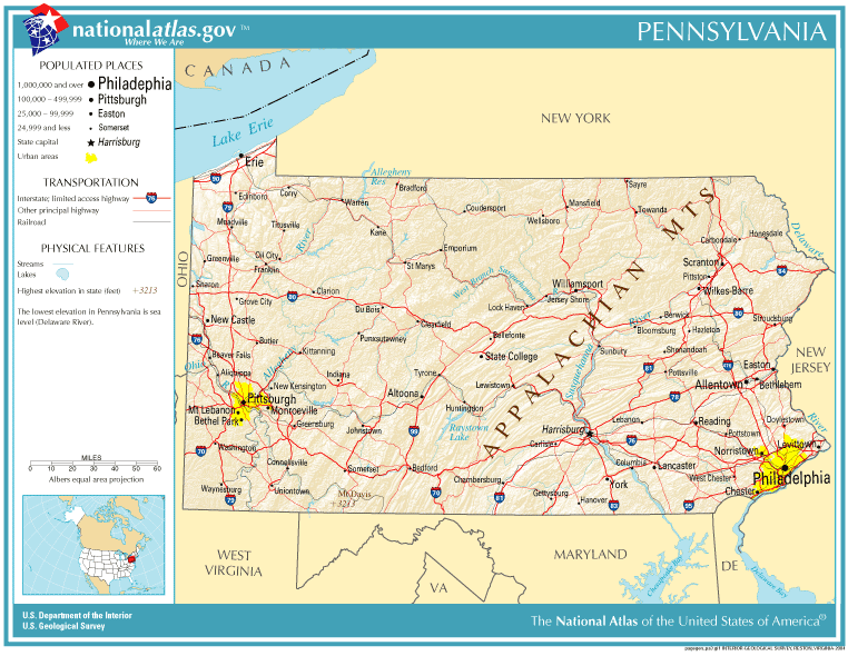
English: Map of Pennsylvania. |
| Dato | |
| Kilde | National Atlas |
| Forfatter |
Licensering
This map was obtained from an edition of the National Atlas of the United States. Like almost all works of the U.S. federal government, works from the National Atlas are in the public domain in the United States.
Online access: NationalAtlas.gov | 1970 print edition: Library of Congress, Perry-Castañeda Library
|
Filhistorik
Klik på en dato/tid for at se filen som den så ud på det tidspunkt.
| Dato/tid | Miniaturebillede | Dimensioner | Bruger | Kommentar | |
|---|---|---|---|---|---|
| nuværende | 14. okt. 2005, 21:10 | | 762 × 590 (140 KB) | Warden | Reverted to earlier revision |
| 11. sep. 2005, 20:19 |  | 762 × 590 (140 KB) | Shauni | {{PD-USGov-Atlas}} Category:Maps of Pennsylvania |
Filanvendelse
Den følgende side bruger denne fil:
Global filanvendelse
Følgende andre wikier anvender denne fil:
- Anvendelser på ast.wikipedia.org
- Anvendelser på bn.wikipedia.org
- Anvendelser på ca.wikipedia.org
- Anvendelser på en.wikipedia.org
- Anvendelser på es.wikipedia.org
- Anvendelser på io.wikipedia.org
- Anvendelser på ja.wikipedia.org
- Anvendelser på mk.wikipedia.org
- Anvendelser på mr.wikipedia.org
- Anvendelser på new.wikipedia.org
- Anvendelser på nl.wikipedia.org
- Anvendelser på ru.wikipedia.org