Fil:North Terrace in 1938.jpg
Størrelse af denne forhåndsvisning: 800 × 550 pixels. Andre opløsninger: 320 × 220 pixels | 640 × 440 pixels | 993 × 683 pixels.
Fuld opløsning (993 × 683 billedpunkter, filstørrelse: 187 KB, MIME-type: image/jpeg)
|
|
Denne fil er fra Wikimedia Commons. Beskrivelsen af filen fra Commons er gengivet nedenfor. |
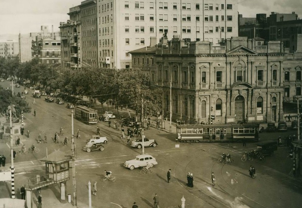
| Beskrivelse | Intersection of North Terrace and King William Street, Adelaide in 1938. | ||||
| Dato | |||||
| Kilde | Flickr: North Terrace 1938 - State Library of South Australia | ||||
| Forfatter | Not specified in the source | ||||
| Tilladelse (Genbrug af denne fil) |
Denne fil er udgivet under Creative Commons Navngivelse 2.0 Generisk-licensen
|
||||
| Andre versioner | Larger version (3,174 x 2,347 pixels) at the website of the State Library of South Australia. Item B 10407. |
| Kameraposition | | Dette og andre billeder på deres position på: OpenStreetMap |
|---|
Filhistorik
Klik på en dato/tid for at se filen som den så ud på det tidspunkt.
| Dato/tid | Miniaturebillede | Dimensioner | Bruger | Kommentar | |
|---|---|---|---|---|---|
| nuværende | 9. dec. 2013, 20:25 | | 993 × 683 (187 KB) | Steinsplitter | Cropped 2 % horizontally and 4 % vertically using CropTool. |
| 9. dec. 2011, 11:33 |  | 1.016 × 708 (144 KB) | Flickr upload bot | Uploaded from http://flickr.com/photo/32600408@N06/3331207167 using Flickr upload bot |
Filanvendelse
Den følgende side bruger denne fil:
Global filanvendelse
Følgende andre wikier anvender denne fil: