Fil:CQA Four Mile Bridge.jpg
Størrelse af denne forhåndsvisning: 753 × 600 pixels. Andre opløsninger: 301 × 240 pixels | 603 × 480 pixels | 964 × 768 pixels | 1.280 × 1.020 pixels | 2.560 × 2.039 pixels | 4.624 × 3.683 pixels.
Fuld opløsning (4.624 × 3.683 billedpunkter, filstørrelse: 1,88 MB, MIME-type: image/jpeg)
|
|
Denne fil er fra Wikimedia Commons. Beskrivelsen af filen fra Commons er gengivet nedenfor. |
|
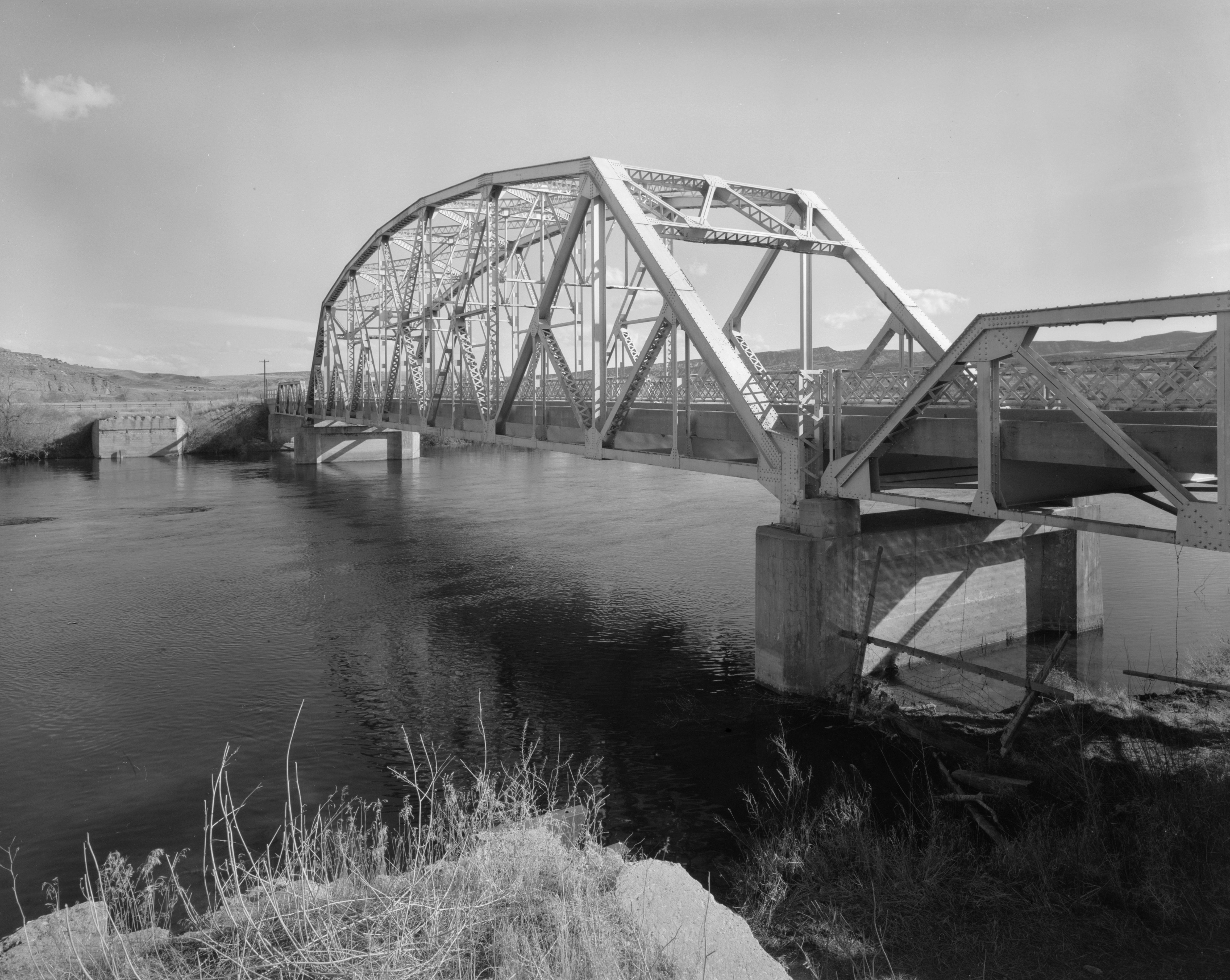
This is an image of a place or building that is listed on the National Register of Historic Places in the United States of America. Its reference number is 85000423. |
| Kameraposition | | Dette og andre billeder på deres position på: OpenStreetMap |
|---|
| Beskrivelse |
English: Eastern side of the CQA Four Mile Bridge, which carries WYO 173 over the Bighorn River near Thermopolis in Hot Springs County, Wyoming, United States. Built in 1927, this Pennsylvania through truss bridge is listed on the National Register of Historic Places. |
||||
| Dato | |||||
| Kilde |
Library of Congress, Prints and Photograph Division HAER: WYO,9-THERM.V,2-1
|
||||
| Forfatter | Clayton B. Fraser | ||||
| Tilladelse (Genbrug af denne fil) |
|

Filhistorik
Klik på en dato/tid for at se filen som den så ud på det tidspunkt.
| Dato/tid | Miniaturebillede | Dimensioner | Bruger | Kommentar | |
|---|---|---|---|---|---|
| nuværende | 27. apr. 2009, 18:14 | | 4.624 × 3.683 (1,88 MB) | Martin H. | high res; cropped |
| 25. apr. 2009, 17:18 |  | 1.024 × 820 (170 KB) | Nyttend | {{Location|43|36|13|N|108|11|48|W}} {{Information |Description={{en|Eastern side of the {{w|CQA Four Mile Bridge}}, which carries {{w|Wyoming Highway 173|WYO 173}} over the {{w|Bighorn River}} near {{w|Thermopolis, Wyoming|Thermopolis}} in {{w|Hot Springs |
Filanvendelse
Den følgende side bruger denne fil:
Global filanvendelse
Følgende andre wikier anvender denne fil:
- Anvendelser på arz.wikipedia.org
- Anvendelser på ca.wikipedia.org
- Anvendelser på ceb.wikipedia.org
- Anvendelser på de.wikipedia.org
- Anvendelser på en.wikipedia.org
- Anvendelser på no.wikipedia.org
- Anvendelser på sv.wikipedia.org
- Anvendelser på www.wikidata.org
- Anvendelser på xmf.wikipedia.org