Fil:SWE-Map Län,1997.svg

Size of this PNG preview of this SVG file: 263 × 599 pixels. Andre opløsninger: 105 × 240 pixels | 211 × 480 pixels | 337 × 768 pixels | 450 × 1.024 pixels | 900 × 2.048 pixels | 290 × 660 pixels.
Fuld opløsning (SVG fil, basisstørrelse 290 × 660 pixels, filstørrelse: 54 KB)
|
|
Denne fil er fra Wikimedia Commons. Beskrivelsen af filen fra Commons er gengivet nedenfor. |
| Beskrivelse |
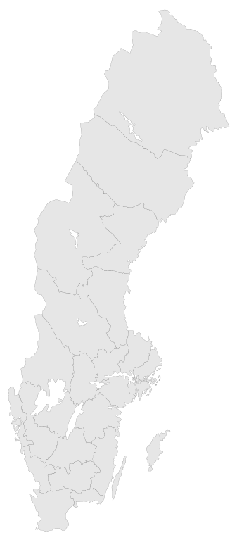
English: A blank map of the Counties of Sweden 1997-1997. The map has all paths tagged (CSS compatible) by the County Codes.
In 1998 Göteborgs och Bohus, Skaraborg and Älvsborg county merged to form Västra Götaland County. For info on how to easiest edit the map see SWE-Map DocumentationSvenska: En tom karta över Sveriges län 1997-1997.
1998 slogs Göteborgs och Bohus, Skaraborgs och Älvsborgs län ihop till Västra Götalands län. För information om hur kartan lättast modifieras se SWE-Map Documentation |
| Dato | |
| Kilde |
The map was edited and modified by Lokal_Profil from SWE-Map Kommuner.svg.
|
| Forfatter | Lokal_Profil |
| Tilladelse (Genbrug af denne fil) |
Denne fil er udgivet under Creative Commons Navngivelse – Del på samme vilkår 2.5 Generisk-licensen Kreditering: Lokal_Profil
SCB allow free use (including commercial use and derivative work) of their map data, see below permission for confirmation |
| Andre versioner |
|


Filhistorik
Klik på en dato/tid for at se filen som den så ud på det tidspunkt.
| Dato/tid | Miniaturebillede | Dimensioner | Bruger | Kommentar | |
|---|---|---|---|---|---|
| nuværende | 2. maj 2010, 03:42 | | 290 × 660 (54 KB) | Lokal Profil | Need to save changes BEFORE uploading |
| 2. maj 2010, 03:39 |  | 290 × 660 (54 KB) | Lokal Profil | Minor correction | |
| 1. maj 2010, 20:46 |  | 290 × 660 (54 KB) | Lokal Profil | {{Information |Description={{en|A blank map of the Counties of Sweden 1997-1997. The map has all paths tagged (CSS compatible) by the County Codes. In 1998 Göteborgs och Bohus, Skaraborg and Älvsborg county merged to form [[:Category:Västra Götalands |
Filanvendelse
Der er ingen sider der bruger denne fil.